Hello, my name is Barbara Muren, Network Manager at Snively Elementary in Winter Haven, FL. I am also a Teacher Consultant with the Florida Geographic Alliance. The purpose of this site is to provide information about the project and a place to communicate Live from the Field with the students at Snively Elementary. The subjects we will be focusing on are science, geography, math, music, and technology. From August 27th to Sept. 2nd, I will post pictures and keep a journal of the daily activities aboard the research sailboat, Silurian. This is all possible through a generous grant given by National Geographic Education Foundation in support of the Earthwatch Education Fellowship Program and a grant from the National Geographic Education Foundation to promote geographic literacy through field research, technology, and collaboration. Thank You, also, to Polk County School Board, my principal, Dr. Joann McKinney, and all the teachers and students at Snively Elementary for their ongoing support. Especially Ms. Lambeth, thank you for making it possible to video conference.
Where are the Hebrides?
The Hebrides are a group of inner and outer islands off the west coast of Scotland. This link www.whaledolphintrust.co.uk is a great description of the Hebrides and also includes a map. * Use this United Kingdom Map to find Tobermory, Isle of Mull, an inner island of the Hebridean Sea. It is our rendezvous point for this project. For a real cool view, use your Google Earth program and fly to Tobermory.
What specific Whales and Dolphins are we researching?
The focus of our research includes the harbor porpoise, minke whale, bottlenose dolphin, grey and common seals and basking sharks. * Check out: HWDT for great descriptions and images.
Why are we collecting data on the Hebridean cetaceans?
The information will identify particular areas of importance or "hotspots" for cetaceans. This will provide an effective conservation strategy, the conservation of marine environment. Results: economic and social benefits to the whole region and protected areas for the cetaceans. * Check out: HWDT
Is there a specific time to do this research?
This project has expeditions running from mid April till the end of September. Moreover, the community members of the area are thoroughly involved with the research. Even visitors can fill out an online form of their exciting sightings. * Check out: HWDT

Today is 4/8/2025 · Did you know...that in Scotland... a lake is called a 'loch' and a strait is called a 'firth' and a sound is called 'kyle'?

Wednesday, August 30, 2006

Day 3 - Anchorage at Loch Sween


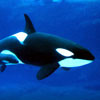
Day 3 – Lat 56 degrees 01.800N Lon 005 degrees 35.458W Air temp = 14 degrees C water temp = 11.1 degrees C. Tucked nicely by Loch Sween. We, (the brave ones) fancied ourselves with a brisk swim in the Loch. Of course, the Floridean dressed for the occasion. Seals were by but didn’t come close enough for an encounter. We ended our day with a top notch dinner – mussels, prawns and haddock with broccoli & crisp potatoes. What a gorgeous day it was! It was very windy at times but for the most part calm and sunny. We had a few sightings of seals and porpoises – no whales though. We have found that this research stuff is hard work. Well at least tiring. From the get go, we have breakfast, discuss our plans for the day – the route we plan to take and then it’s research time. We are broken down into pairs – two standing at the mask pole switching sides after a half hour, two collecting the data sightings – one which is perched at the computer & the other at the companion way, with the other two ‘off duty’. The pairs rotate every hour and we keep rotating until we reach our next anchorage. It is very important that we collect accurate data and on time data. For example, we need to do an environment conditions data collection every 15 minutes. Question for the day is “Why do you think it is important to have this environment conditions information for this sightings research?”

0 Comments:

Post a Comment

<< Home