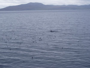
Layout of Sightings for Aug.27 - Sept.2

posted by barefootin' @ Tuesday, September 05, 2006
0 comments
![]()


|
Earthwatch Institute engages people worldwide in scientific field research and education to promote the understanding and action necessary for a sustainable environment. We believe that teaching and promoting scientific literacy is the best way to systematically approach and solve the many complex environmental and social issues facing society today.
| Hello, my name is Barbara Muren, Network Manager at Snively Elementary in Winter Haven, FL. I am also a Teacher Consultant with the Florida Geographic Alliance. The purpose of this site is to provide information about the project and a place to communicate Live from the Field with the students at Snively Elementary. The subjects we will be focusing on are science, geography, math, music, and technology. From August 27th to Sept. 2nd, I will post pictures and keep a journal of the daily activities aboard the research sailboat, Silurian. This is all possible through a generous grant given by National Geographic Education Foundation in support of the Earthwatch Education Fellowship Program and a grant from the National Geographic Education Foundation to promote geographic literacy through field research, technology, and collaboration. Thank You, also, to Polk County School Board, my principal, Dr. Joann McKinney, and all the teachers and students at Snively Elementary for their ongoing support. Especially Ms. Lambeth, thank you for making it possible to video conference. |
|
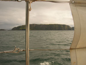
Where are the Hebrides?
The Hebrides are a group of inner and outer islands off the west coast of Scotland. This link www.whaledolphintrust.co.uk is a great description of the Hebrides and also includes a map. * Use this United Kingdom Map to find Tobermory, Isle of Mull, an inner island of the Hebridean Sea. It is our rendezvous point for this project. For a real cool view, use your Google Earth program and fly to Tobermory. What specific Whales and Dolphins are we researching? The focus of our research includes the harbor porpoise, minke whale, bottlenose dolphin, grey and common seals and basking sharks. * Check out: HWDT for great descriptions and images. Why are we collecting data on the Hebridean cetaceans? The information will identify particular areas of importance or "hotspots" for cetaceans. This will provide an effective conservation strategy, the conservation of marine environment. Results: economic and social benefits to the whole region and protected areas for the cetaceans. * Check out: HWDT Is there a specific time to do this research? This project has expeditions running from mid April till the end of September. Moreover, the community members of the area are thoroughly involved with the research. Even visitors can fill out an online form of their exciting sightings. * Check out: HWDT |
posted by barefootin' @ Tuesday, September 05, 2006
0 comments
![]()
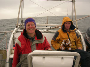
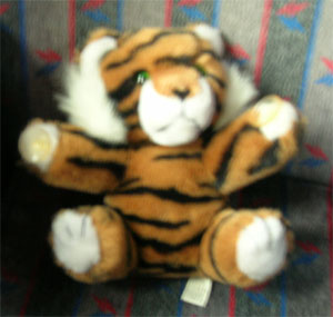
WOW, what an adventure it has been! By plane, bus, shuttle, train, car, ferry and my own two feet - we have seen practically all of Scotland, Orkney Island and the Hebrides!!! I'd like to first off say THANK YOU to Marcia McKinney for all of her help back at Snively. Without her many of the students would have missed out on this wonderful experience and for the valuable communication connection that she provided. Thank you to Dana Robertson, too, for her help with the Scotland travel bulletin wall and with the ITV program. Thank you to ALL the staff at Snively for giving your students the opportunity to virtually experience Scotland and the Cetaceans of the Hebrides. Thank you to HWDT for the opportunity to help with the conservation of this species and our environment. Thank you to Earthwatch Institute, the Earthwatch Education Fellowship Program, National Geographic Education Foundation, and the Florida Geographic Alliance to promote geographic literacy through field research, technology, and collaboration!!!!!!! Thank you to the Silurian crew - Peter, Gen, Laura, Hilda, Sarah, Louise, Lizzie, Karen, Jan, Tiger, sheepy, and friends. The spectacular cast in the Hebridean Islands. (Sighting - 100 meters) Oh yeah, Thank you to MOM and Barney for all of their loving support! CHEERS ALL! Love, Ms. Barb Muren
posted by barefootin' @ Tuesday, September 05, 2006
0 comments
![]()
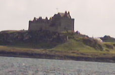
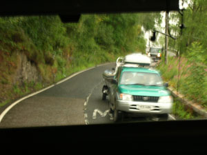
Day 6 - Back home in Tobermory.
posted by barefootin' @ Friday, September 01, 2006
0 comments
![]()

posted by barefootin' @ Thursday, August 31, 2006
0 comments
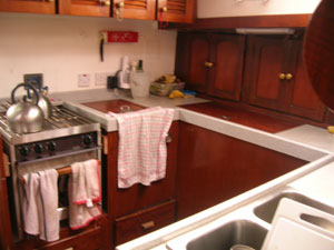
![]()
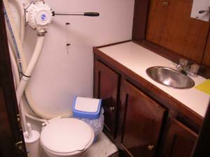
Galley


posted by barefootin' @ Thursday, August 31, 2006
0 comments
![]()
Day 4 – Wednesday Lat 55° 57.584N Lon 55° 55.048W Anchored in Loch Tarbert Jurar after passing through the Sound of Islay. We are met with wind gusts up to 25 knots and rain. It is mighty chilly for the Floridean – the Brits are even wimping. We had a quiet tour of
posted by barefootin' @ Thursday, August 31, 2006
0 comments
![]()
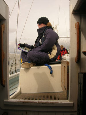
 I braved the crows nest which is about 20 feet up. A not-so-bad climb and safe since you are harnessed in a safety strap in case you slip. It is definitely worth the view.
posted by barefootin' @ Wednesday, August 30, 2006
0 comments
![]()
 When we anchored at Loch Sween, we put out a creel pot to see what we would catch and possibly eat. But no keepers, just some small green and brown crabs.
posted by barefootin' @ Wednesday, August 30, 2006
0 comments
![]()
Leaving Loch Sween heading South to survey the Southern part of the Sound of Jura. Then heading North up the Sound of Islay towards anchorage in West Loch Tarbert which is on the West Coast of Jurar.
posted by barefootin' @ Wednesday, August 30, 2006
0 comments
![]()

posted by barefootin' @ Wednesday, August 30, 2006
0 comments
![]()
Day 3 – Lat 56 degrees 21.908N Lon 005 degrees 41.131 W. Air temp = 16 degrees C. Water temp = 53.6 degrees C. Touch of rain in the morning. For the most part sun peaking through the clouds. Leaving Loch Spelve going South down the Firth of Lorn through the Sound of Luing (note the tide rush is very strong here so it is important to get this spot before the tide is coming in as to not use as much gas) then past Scarba – which is a slate island into the Gulf of Corryreckan’ entering the Sound of Jura. We will make anchor somewhere by Loch Sween.
posted by barefootin' @ Tuesday, August 29, 2006
0 comments
![]()
Day 2 – anchorage at Loch Spelve. A few of us made a quick run to shore in a small rib, for a few last minute items. After being assured that all weather gear was not required it was typical that we all got absolutely drenched in a sudden summer downpour on our return to the Silurian. A humorous and very wet start to the first day of our adventures! The rest of us sure were pleased we’d decided just to hang out onboard in the dry as soon as we saw the state the others came back in!
posted by barefootin' @ Tuesday, August 29, 2006
0 comments
![]()
The air temp = 14 degrees C and the water temp = 24 degrees C. Students using the conversion formula, figure out what these temperatures would be in Farenheit.
posted by barefootin' @ Monday, August 28, 2006
1 comments
![]()
 I slept very well and could sleep even more. It's hard work being a tourist trying to see the sights and not get lost (ohh, the many u-turns and continuous circling in the round-abouts) and I'm sure I heard a few Scottish folk saying to me on the road (Bloody American's!).
posted by barefootin' @ Monday, August 28, 2006
0 comments
![]()

posted by barefootin' @ Monday, August 28, 2006
0 comments
![]()
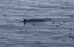
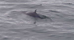
Day 2, Leaving port around noon. Lat N56° 37.205 Lon 06° 03.681 Air Temperature 14° our plan is to head S down the Sound of Mull and anchor at Loch Spelve off of Firth of Lorn. This first leg of our journey is around 20 miles. We hope to see harbor porpoises. August & September is the time when they are calving –so, we should see mother with calf. They are hard to sight because they are so quick when they surface. They prefer areas with a varied topography, because of the nutrients that is found in these areas. The bottlenose dolphins are mainly a coastal species. The left side of the fin is used for photo research. Along with identifying Male – 1 slit Female – 3 slits. They are very social and like to hang out in 2 or 3’s. Common Dolphin feed on mackerel and herring found in large groups of 50 up to 500. They are fast moving and highly active. Minke Whale is an untoothed cetacean of the rorqual whales. They filter their food through their baleen and feed on sandeels, herring, and sprat. They are usually found on their own. Other species we might observe: Killer whale (Orca), Risso’s Dolphin, Humpback Whale. The software program, Logger, is used to map the sightings. The data recorded are species, distance, bearing, heading, number of animals, behavior, any other species associating (birds, etc.), boat traffic, and rubbish. See if you can look at the pictures of these species and compare & contrast their appearance. The thought is “Where would you most likely be if you were a cetacean?”
posted by barefootin' @ Monday, August 28, 2006
0 comments
![]()
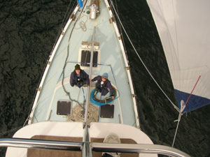
Day 1, Sunday – For the expedition, it began at 6pm. Light – mid rain. 16 degrees C. We gathered at the HWDT visitor center then walked to the sailboat a little ways down the road. With a welcome from Skipper Peter, we boarded the Silurian with the smell of dinner in the air. Our height determined our sleeping bunk. I’m in the furthest forward section of the boat with Karen from London. The evening was spent with getting acquainted with each other while having tea and cookies and going over the safety & boat particulars, - The top of the lists: To flush the loo -pump the handle twenty times (with the lid closed). The location of the satellite beacon in case we need to send an SOS and the rescue team can find us using GPS. Take the karabiner on your life jacket and attach it to the rope line that runs along the floor topside. This will keep you from falling completely overboard – now that’s a pleasant thought.
posted by barefootin' @ Monday, August 28, 2006
0 comments
![]()
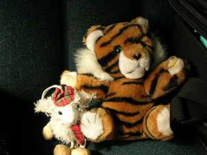
The views here are beautiful. It seems like a melting pot of the cities of the USA. The beaches, lochs and rivers like FL - the wind sometimes like Chicago, IL - the rain and climate like Seattle, WA. The temperatures have been ranging from 13-18 degrees C. It has rained almost everyday but it comes and goes. I have learned so much about the Scotland way. The people are very nice and helpful, especially to a young female trying to find her way. Keep checking the Marquee above for equilvalent sayings. For ex. To Let = For Rent; Eeye = Yes. The usual diet has gone to the way side - eating fish & chips. But with all the walking here and there, Tiger, Sheep & I will be okay. Well, need to go. Internet here is .89 a pound for 15 min.'s. I'm excited and very anxious about the sailboating. My stomach has been dancing all day. I bought wrist bands and dramamin to hopefully way the sea sickness. Cheers for now! Be sure to get with Mrs. McKinney or Mrs. Mastrangelo to post any questions.
posted by barefootin' @ Sunday, August 27, 2006
1 comments
![]()
posted by barefootin' @ Sunday, August 27, 2006
0 comments
![]()


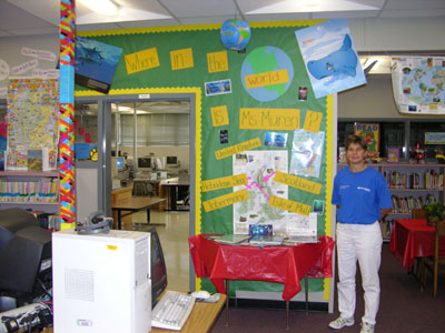
Bulletin Wall in the Media Center at Snively Elementary.
|
|
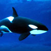
Killer Whales
|
|
|
|